The New York City Emergency Management Department has issued a Travel Advisory in anticipation of a strong storm affecting the region on the evening of Tuesday, January 9, through Wednesday morning, January 10, 2024. Various National Weather Service products have been released in connection with this storm.
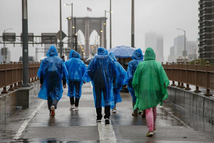
A citywide Flood Watch will be in effect from 6:00 p.m. tomorrow to 12:00 p.m. Wednesday. Rain is expected to begin lightly tomorrow afternoon, intensifying in the evening and persisting into early Wednesday morning. The heaviest rainfall is projected between 9:00 p.m. and 3:00 a.m., with spotty showers continuing until around noon. Thunderstorms and lightning are also possible overnight.
The forecast indicates citywide rainfall of 2 to 3 inches at rates around 0.5 inch/hour, with potential for locally higher amounts and rates. The rising high tide tomorrow evening in New York Harbor and Jamaica Bay may coincide with heavy rain, leading to compound flooding along vulnerable roadways near the shoreline, impacting the evening commute. Widespread minor flooding and localized flash flooding of roadways and properties are anticipated overnight, with residual flooding possible during Wednesday morning’s commute. Areas near the Bronx River may experience significant flooding due to snowmelt and heavy rain upstream.
A High Wind Warning is declared for Brooklyn, Queens, and Staten Island from 6:00 p.m. tomorrow to 6:00 a.m. Wednesday. Additionally, a Wind Advisory is in place for the Bronx and Manhattan during the same period. In Warning areas, southeast winds of 30 to 40 mph with gusts up to 60 mph are expected, reaching their peak between 10:00 p.m. and 3:00 a.m. In Advisory areas, winds of 20 to 30 mph with gusts of 50 mph are forecast. Potential impacts include scattered to widespread downed trees and limbs, power outages, damage to unsecured items, and challenging travel conditions.
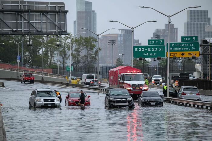
A Coastal Flood Warning is effective for southern Queens from 5:00 a.m. to 9:00 a.m. Wednesday, with a Coastal Flood Advisory in place for Brooklyn, Manhattan, and Staten Island from 5:00 a.m. to 10:00 a.m. Wednesday. Widespread minor to moderate coastal flooding is expected, with up to 2 to 3 feet of inundation possible in Warning areas, and 1 to 2 feet of inundation in Advisory areas. This may lead to widespread flooding of roadways, properties, basements, and first-floor structures, with numerous road closures and flood-damaged vehicles, particularly in southern Queens and Jamaica Bay on Wednesday morning. The tide is expected to peak around 7:00 a.m. Wednesday in New York Harbor and Jamaica Bay, and around 10:00 a.m. in the Long Island Sound. Large breaking waves of 10 to 15 feet and high surf are also likely at Atlantic-facing beaches, causing significant dune erosion and overwash.
New York City Mayor Eric Adams urges residents to take necessary precautions, emphasizing the potential for heavy rains, strong winds, and flooding. He encourages New Yorkers to sign up for Notify NYC to receive the latest information and closely monitor the forecast.
NYC Emergency Management Commissioner Zach Iscol assures that dedicated teams are fully mobilized to respond effectively to the forecasted severe weather. Given the multiple warnings and advisories issued citywide, including the potential for significant coastal flooding in southern Queens, Iscol urges all New Yorkers to take the storm seriously and stay updated through Notify NYC.
In response to the weather forecast, New York City Emergency Management has activated the city’s Flash Flood Emergency Plan, coordinating with the National Weather Service, partner agencies, and utility companies for a unified response.


